Turkey & Greece 2005
Turkey & Greece 2005
Michael Kluckner
Return to main travel page Return to home page
|
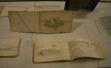
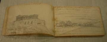
Another ramble in October-November through a beautiful part of Europe, with only carry-on baggage containing a hand-made, 10 x 11 inch watercolour sketchbook (Arches 140# cold-pressed), my Winsor & Newton/Cotman portable paintbox, an Isabey 6202 squirrel-mop travel brush, a small Holbein spray bottle, a Moleskine 5 x 8 inch sketchbook, and a couple of BIC mechanical pencils. This is the same kit I took to Italy in 2004. We were travelling more spontaneously than in some previous trips, and were less settled in specific places (except for a week in a house in Hania, Crete). I found I got a lot of pleasure out of simple pencil drawings in the Moleskine book, and more success with taking the annotated ones and painting from them later, in hotel rooms or wherever, while the memories of colours and places was still really clear. The annotated pencil drawings themselves are, in some ways, a better aide-memoire for me of the places we visited than are the watercolours, although I doubt that they really work for anyone who hasn't been there. As with Italy in 2004, I was determined to finish everything while away rather than bring back a pile of half-finished pieces. Again, the long views à la Turner were my subjects, rather than close-up details à la Sargent. "Torniamo
all'antico, sarà un progresso" --Guiseppe Verdi |
The trip ended in Heidelberg, Germany
|
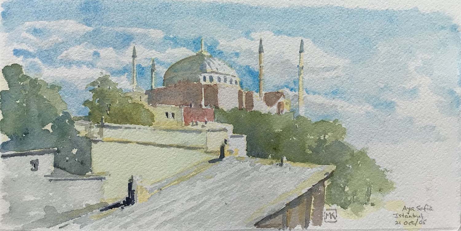
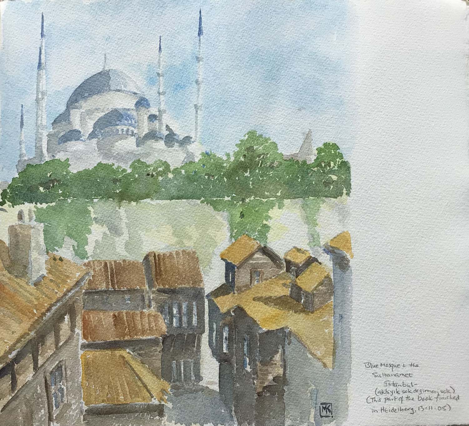
The scale of the religious buildings in Istanbul, and the congestion on the streets, including the curiosity and/or salesmanship of the citizenry, makes painting a challenge, to say the least. We stayed at the tiny Naz Wooden House Inn in Sultanahmet, partly because its roof terrace offered a view of the big mosques and the Bosphorus. A splendid view. Ever since art school, I had wanted to see the Aya Sofia mosque, aka Haghia Sophia, the enormous converted church dating from Justinian's reign in the 6th century AD. It did not disappoint. The watercolour attempts to show it looming above the modest wooden buildings of the old town. |
|
The "Blue Mosque" looms above the Sultanahmet streets of sagging, dilapidated unpainted wooden buildings. I can't think of a place where the opulence of a church or mosque contrasts so sharply with its neighbours. These streets, called I think the Akbiyik Sok, are a backwater off the well-maintained Sultanahmet streets of hotels, restaurants and shops nearby, and are hidden below the huge retaining wall of the mosque.
|
|
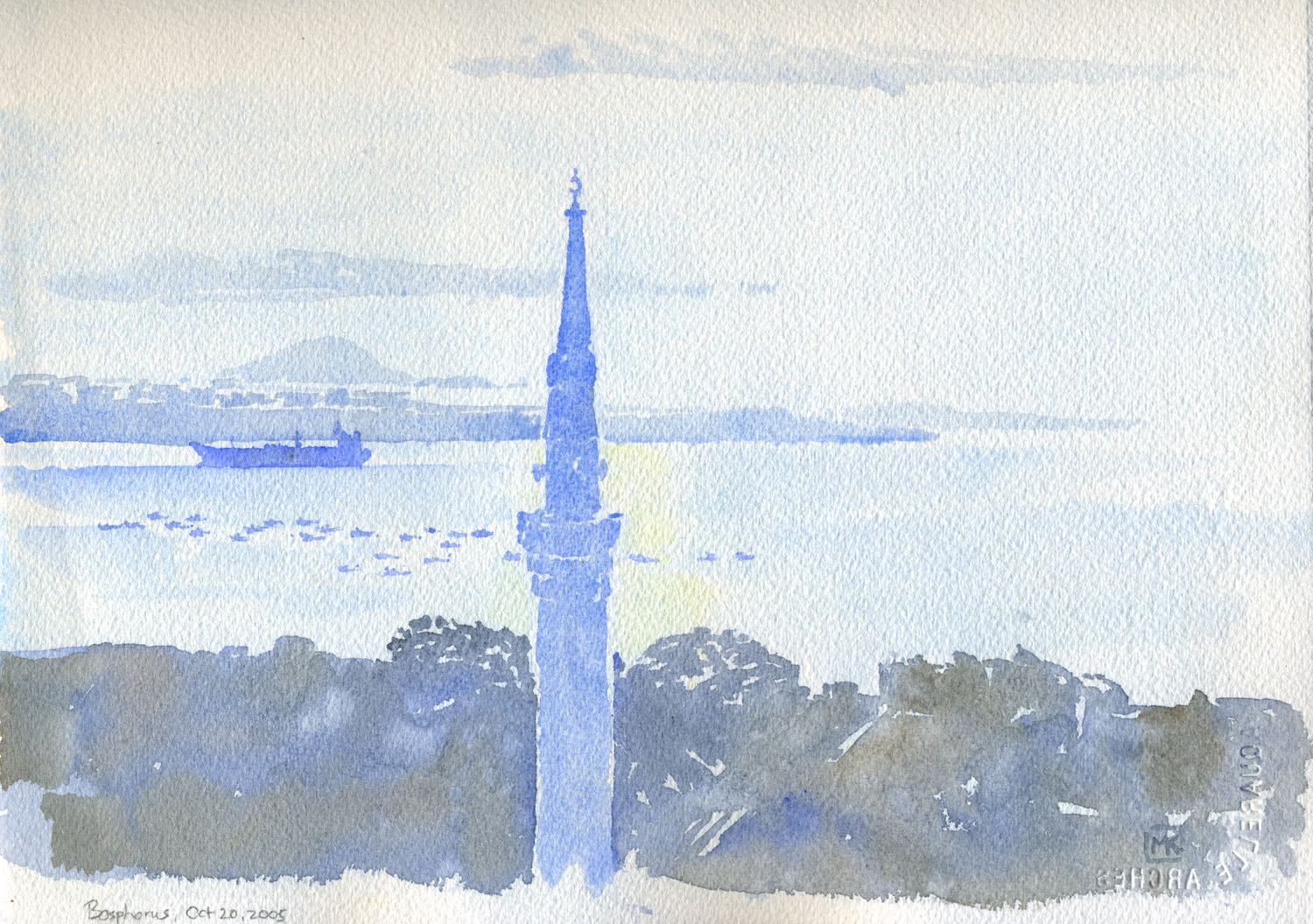
October 19, 2005, 8 am: looking the other way (south) from the roof terrace of the Naz Wooden House Inn toward the Bosphorus, which widens out on the right into the Sea of Marmara. A single minaret, bristling with loudspeakers for the four-times daily prayers, aggressively protrudes above the modest roofs. The freighter was likely on its way to a port on the Black Sea. Every morning, a few dozen small fishboats positioned themselves between the shore and the main shipping lane. |
|
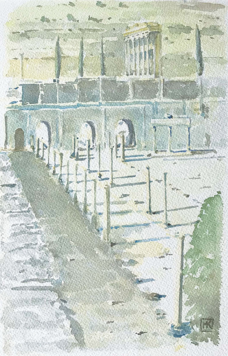
Ephesus, near Selçuk on the "Asia Minor" (Aegean) coast, is the fabulous ruined Roman city, better than Troy or Pergamum. I sat on the edge of a wall with a view of the surviving facade of the Library of Celsus and the three arches of the Gate of Mazaeus and Mitridates, two former slaves of the Emperor Augustus. The low morning light (October 22) created a horizonal rhythm of shadows to complement the vertical rhythm of the orphaned columns. [No pencil -- I did a pencil drawing in the Moleskine book on site and painted the picture that evening in the hotel room in Kusadasi; cadmium yellow underpainting of the background hill and all the shadowed areas in the foreground, with detailed reserved as "negative space". The shadow colours are mostly a mix of sepia and ultramarine, with cerulean added in some places. A few weeks later, near the end of the trip, we found ourselves in Como, Italy, at the Museo Civico. There was an exhibition honouring the centenary of the death of archaeologist Alfonso Garovaglio, "la sapienza del lago," displaying among other artifacts his sketchbooks from trips through the Middle East and "Persia" 125 years ago. They are small books with grid lines, drawn with a very sharp pencil. It was intriguing to see this man's drawings, supplementing the photographic documentation on the expedition, and the sorts of details he was recording to aid his work.
|
|
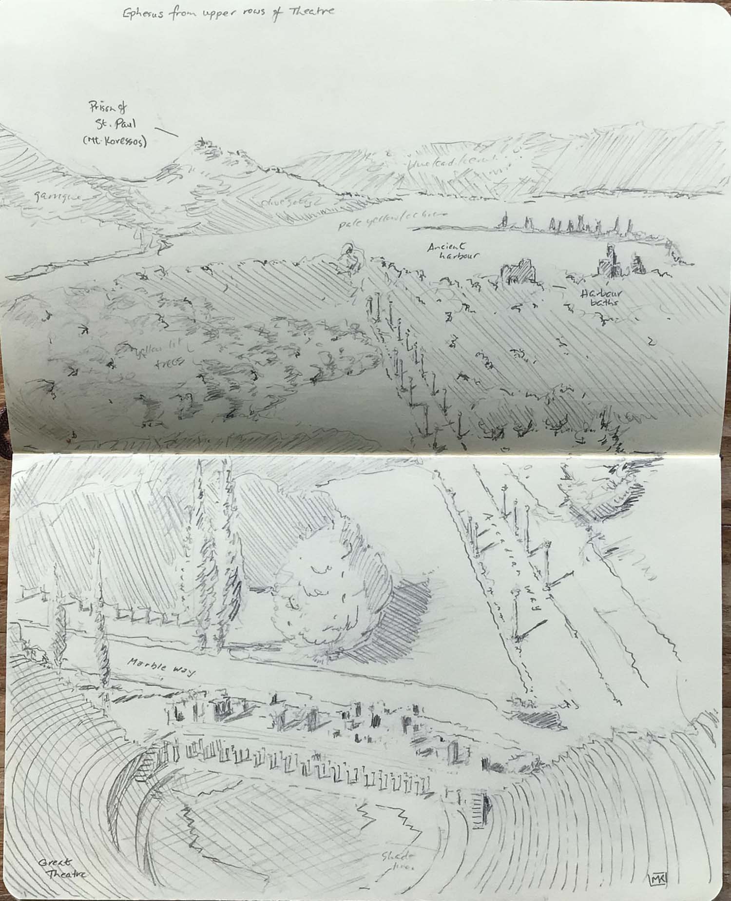
The highlight of Ephesus is the Great Theatre, dating from Hellenistic times but expanded during the reign of Emperor Claudius. It could (and can) seat 25,000. I was fascinated by the view from about 2/3 of the way up, in the cheap seats, along the Arcadian Way with its line of columns toward the long-ago silted-up ancient harbour – the bay at the mouth of the small Kaystros river. The hill on the left has a ruined tower and fortress, in which St. Paul was allegedly imprisoned after his lecture at the theatre* The photographs we take on trips distort space. Photographs always look so vast, with too much foreground and a compressed middleground and background, unless you use a telephoto, in which case they're too tight. They are wonderful for capturing detail in towns, or the curiosities of the modern roadside, but never give me a sense of depth, or the feeling of height or the way a landscape fits together. So a drawing like this -- a bird's-eye view with annotations -- is a more accurate memory. *Note from Stephanie Gould: The references for St. Paul would
be: 1 Corinthians 15:32 (uncertain whether this is a reference
to the riot of the silversmiths at Ephesus, "the first recorded
instance of hostility to the Christians exhibited by Gentiles"--
John L. McKenzie, S.J., Dictionary of the Bible, New York:
MacMillan Publishing Co., 1965). All of 1Corinthians was written
from Ephesus. And there is also The Epistle of Paul the Apostle
to the Ephesians in the New Testament. |
|
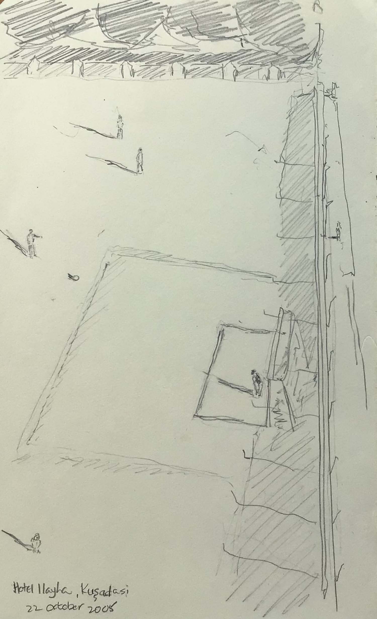
Kusadasi is the Turkish port near Selçuk and Ephesus. It is a garish, modern place with a nice beach and lots of the resort accoutrements that draw hedonists on a budget from Germany and Britain to the Aegean and Mediterranean. From Istanbul, we had booked into the Hotel Ilayha on the esplanade, but found ourselves in a room facing toward the town, which gave me the opportunity to reflect on the country's major preoccupation. The boat leaves daily from Kusadasi to Samos, one of the Dodecanese islands that are part of Greece despite being within sight of the Turkish coast. |
|
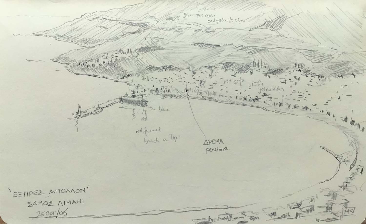
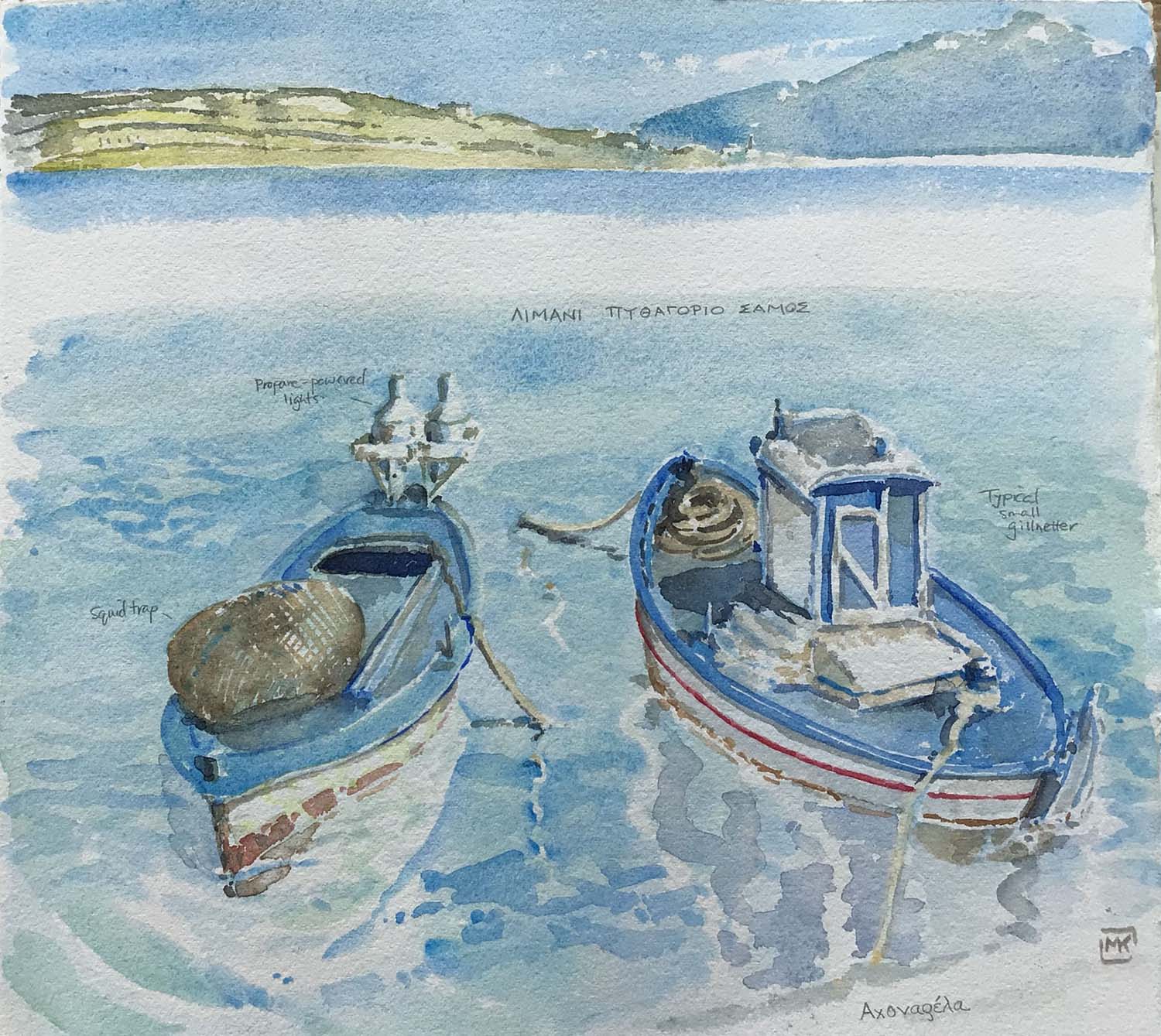
Samos is a large, quite green, pretty island, a gentle eternal-summer place. We landed from Turkey at the port of Vathi, aka Samos Town, and took a pensione, called "Dreams," for a few days. One day we rented a motor scooter in order to get out a ways along the coast, and to get to the viewpoint above the town to sketch it. The "Express Apollon" is the ship waiting at the dock, which we took overnight from Samos to Piraeus (the port of Athens). (Below) on one day, we took the local bus across the island to Pythagoreo, renamed recently for its famous native son, the mathematician. Good old Pythagoras... In the absence of an interesting view, I succumbed to the fishboat cliché. |
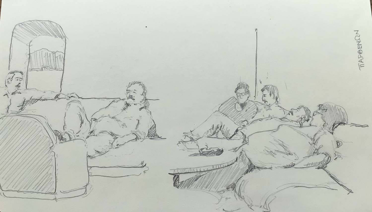
| The ship left Samos in the late afternoon and by the time it stopped at Ikaria it was already dark. In the 2nd class lounge, Greek families camped out for the night. As wealthy foreigners, we had a cheap windowless cabin, to which we retired after we ate the spanikopitas, drank the wine, and sketched the snoozers. |
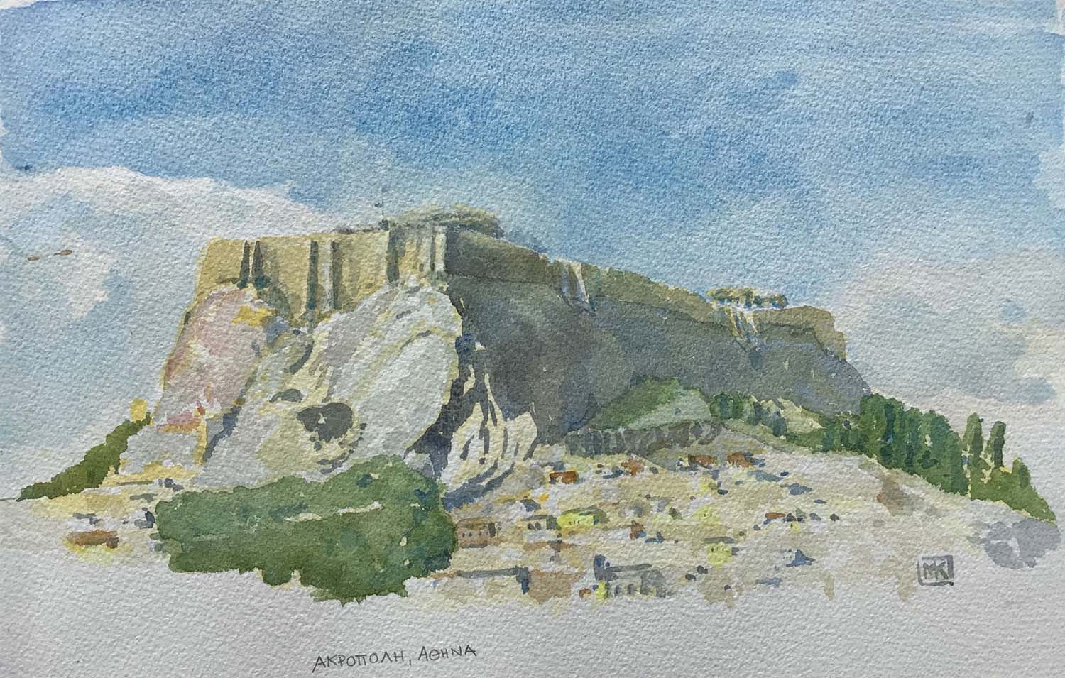
| The Acropolis in Athens, from the roof terrace of the Hotel Adonis in Plaka, the old part of the city which, until a century ago, was all there was. Today Athens is home to about 4 million of Greece's 11 million citizens. |
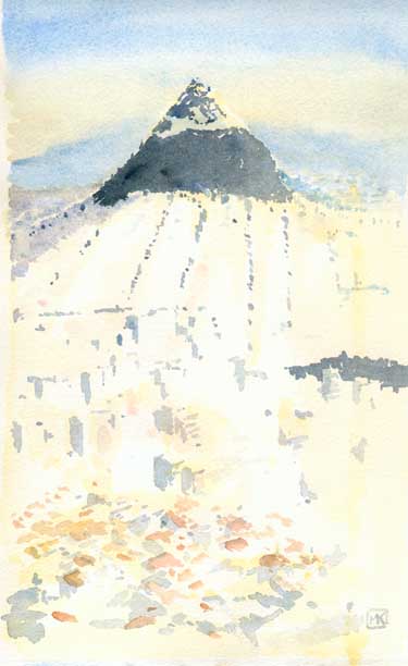 |
Lykavittos Hill seen from the Acropolis at sunrise. We were in the first few on the Acropolis when it opened at 8am on October 26, just after Greece had reverted to Standard Time. So we were there to witness Greek soldiers raising the flag and singing the national anthem when the sun finally rose and bathed the Parthenon in golden light (no I didn't paint it – I took a photo). Lykavittos is the highest of the Athens hills, a wooded island in the midst of the city. On the drawings I did that morning from the Acropolis, I wrote "endless sea of sunlit white/yellow/pink buildings" to try to define the extraordinary sight of the city extending for miles in every direction. All concrete, all golden in the mix of sunlight and smog, a creamy colour that perhaps you could only get precisely with oils. In the foreground of the image, the red roofs and random layout define the old district of Plaka.
|
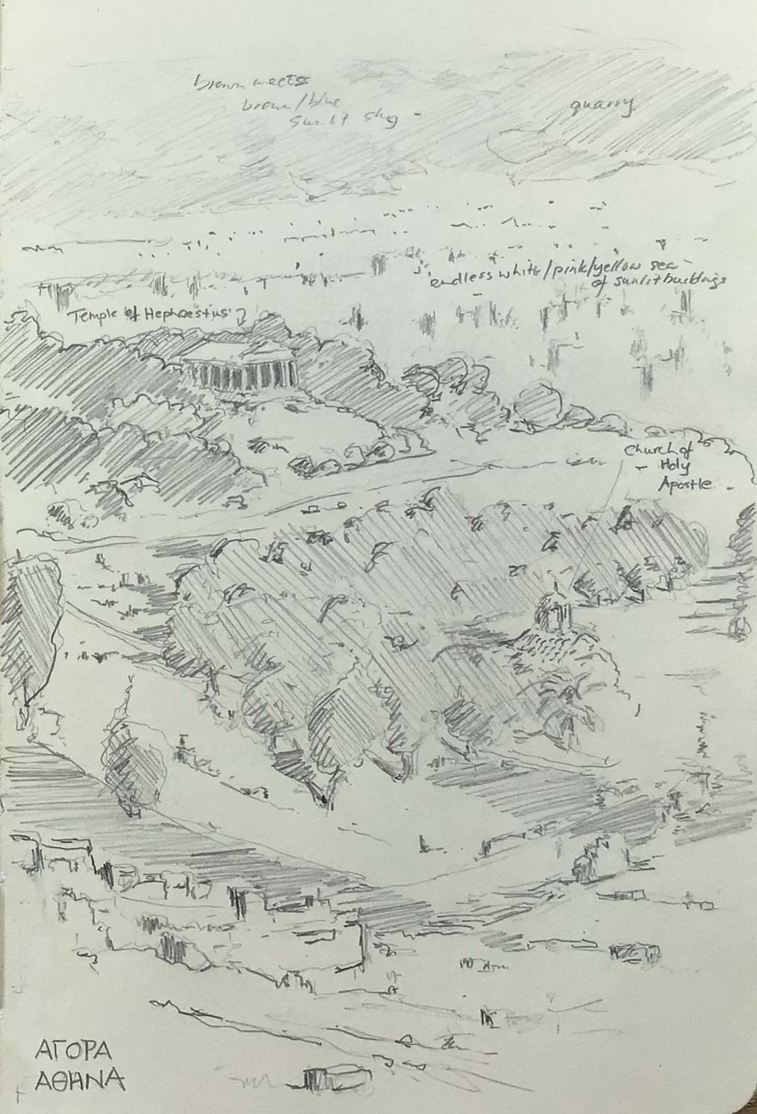
| A pencil sketch of Athens, of the Agora – the former market area – on the slopes of the Acropolis. I was surprised by how extensive ancient Athens is, and how it sits like a tranquil island in the midst of the chaotic modern city. |
|
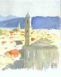
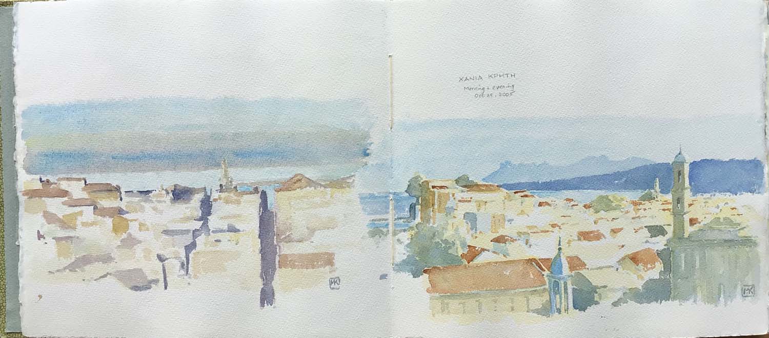
Chania (pronounced Hania) is Crete's second largest town, developed mainly by Venetians, although there was a period of Ottoman occupation, with a large modern town and port nearby. (On the left) At the southwest corner of the surviving fortifications ringing the old town, there is a circular redoubt that provides a viewpoint. Early in the morning of October 29, I sat on the wall there and looked east at the sun-drenched, late-summer city and distant coastline. (On the right) Same place as above, just as the sun was setting, but looking north toward the lighthouse, with the breakwater of the ancient harbour just visible. |
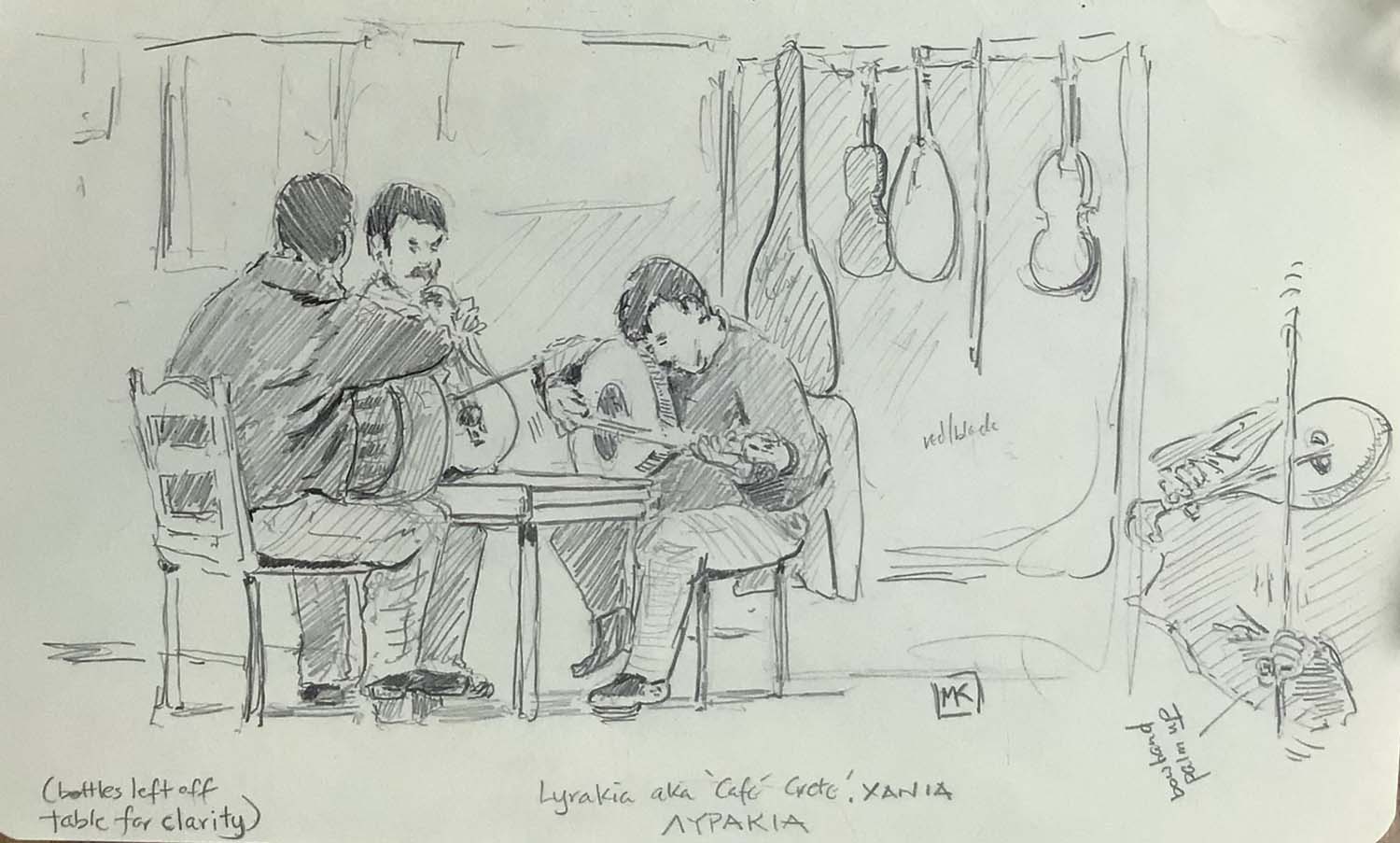
| The Lyrakia café, near the old shipyards (the Enetika Neoria) on the Chania waterfront, is a centre of Cretan folk music. Jam sessions most nights with a mix of players, a lot of rhythmically complex laments and ballads and a really engaging, hypnotic sound. It seemed to me that the standard Cretan ensemble was two guys playing laoutos (the long-necked lutes) and one playing the lyra (the pear-shaped fiddle; the bow hand is always palm up). One or more of them would sing. It was a blast: for 6 euros we were given a plate of olives and bread and a carafe of wine, and at one point a few of the locals danced. (I later found a CD of Cretan folk music, by Sifi Tsourdalakis, that brings it all back.) |
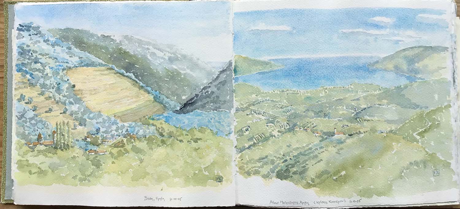
| (Above) For the last few days on Crete, we rented a small
Citroen and set out to explore the island. Day 1: the long winding
road to Elafonisos at the southwest corner. At Vathi, a tiny spot
where the road begins to descend from the central mountains toward
the sea, I stopped to paint. Much of the ground is terraced. Olive
trees are the native forest on high ground; chestnuts, just
beginning to change colour, occupy the valleys. The distant hills
are even drier and rockier, the vegetation a green-gray "garrigue"
like much of the Mediterranean. In the distance, the pale blue
triangle is the Sea of Libya. On the right, at a dot on the map called Malathyros, in the mountains behind Kissamos, we stopped to eat lunch on the roadside and gazed across the vast rolling landscape of olive groves and villages toward the Gulf of Kissamos. The view looks north toward the Sea of Crete near the northwest corner of the island. |
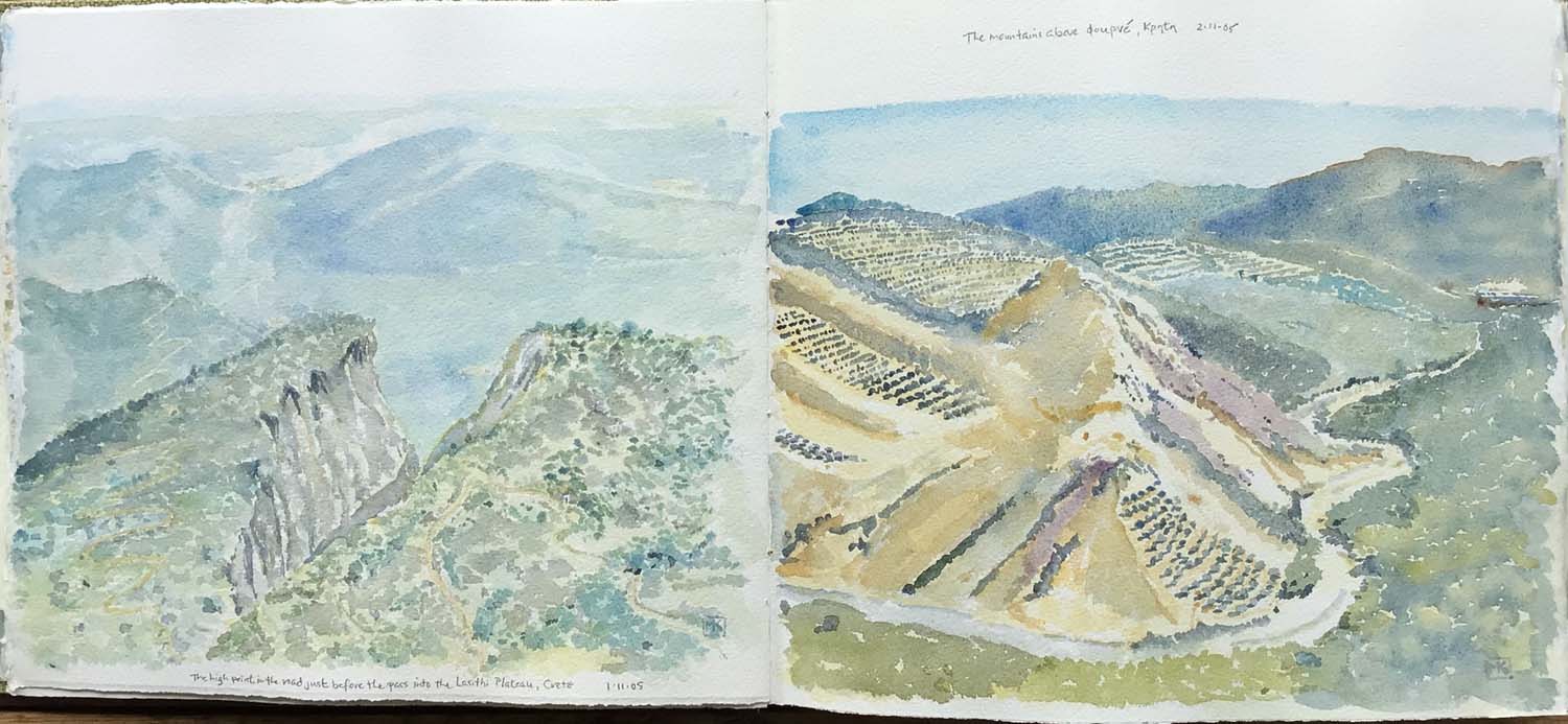
| (Above) Day 2, took a long trip on the national highway, which
follows the north coastline from Chania to Iraklio and eastwards.
Our destination: the Lasithi Plateau, a mountain-ringed patchwork
of farmland 900 m. above sea level. It was interesting in its own
way, but the trip through the mountains to the entrance to the
plateau was fantastic. I became almost a mapmaker in the
watercolour above, which looks north toward the Sea of Crete. It
was the roughest landscape imaginable, a "garrigue" of low thorny
bushes with the occasional twisted olive tree, a jumble of rocks
(much of it pummice from the ancient volcanic eruptions that,
among other things, destroyed Knossos and the Minoan civilization)
and wild precipices. Yet in the midst of this wild fastness, there
is always the clonking sound of goat and sheep bells, with flocks
scattered across the landscape and grazing on the almost vertical
slopes, tiny villages and scattered shelters. I have never, in all
my travels, seen such a combination of stupendous natural
landscape with so many layers of culture and settlement. If you
go, stop at the Taverna Kares in the tiny town of Krassi for
traditional Cretan food – the young woman who co-owns it is
Swiss-French, so she speaks a little English as well as French,
German, Italian and, of course, Greek. On the right, Day 3: on another route, south from Cania toward the Omalos Plateau (less impressive than the Lasithi) and the entrance to the famous Samaria Gorge, a hike we will save for another trip. On the way, the road climbs steeply through sun-washed groves of lemons and oranges, changing to platted-out olive trees as the road climbs higher and the land gets dryer. Past Fourne, the rough slopes are all terraced, with the steepest ones clothed in a mauve heather, plus lavender and rosemary. Chestnuts fill the valley bottom. |
|
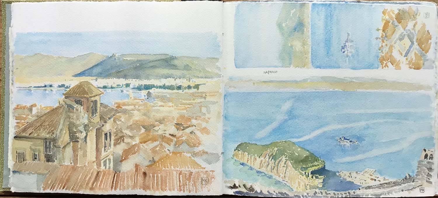
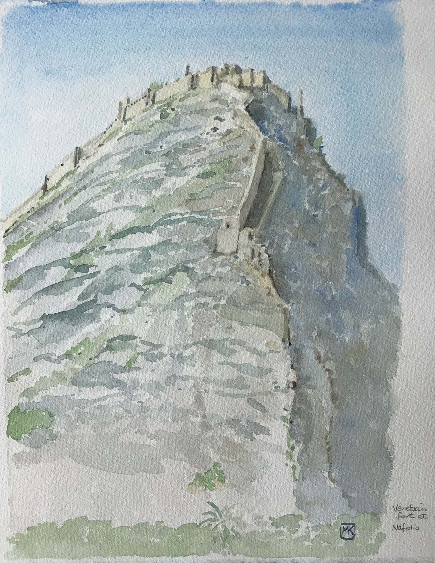
(Above) Nafplio, another Venetian port on the Peloponnesse and the port for Argos. Expensive, but a very pleasant place to spend several days. Its hulking, wooded former acropolis guards the old town. Above it all is a rock outcropping on which the huge Palamidi fortress sits. Floating like a ship on an islet in the harbour is the curious, medieval Bourtzi fort (ironically, the only reason I had ever heard of Nafplio, because a photo of it was one of the scenes on the "Visit Greece" placemats in every Greek restaurant in western Canada for years). [For other travelling sketchers: the water is the biggest challenge, as it has to be painted on very wet paper while dropping out the precise shape of the Bourtzi fort and the acropolis/town; painting the colour of the Mediterrean/Aegean is a challenge at the best of times, as it is a luminous, translucent blue/turquoise colour that has extraordinary depth to it. I used manganese blue with added mixes of manganese/cerulean and cerulean/ultramarine, keeping the paper wet enough to sponge out the pale lines of the currents, and adding a little viridian for the shallows on the near side of the acropolis. The acropolis itself is sienna over a cadmium yellow deep wash, with viridian/olive green mix over the cadmium for the greenery. The shadow of its fortification is pure ultramarine.] Below: the Palamidi fortress. |
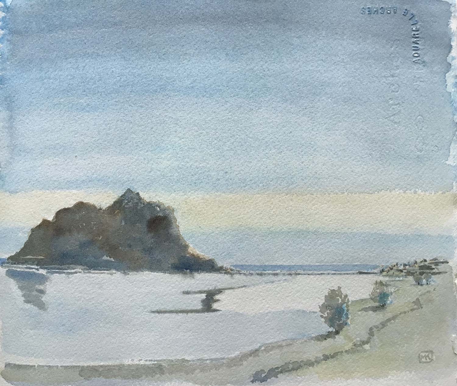
| Monemvasia is a rocky peninsula that became an island following an earthquake in 375 AD. It is at the southeast extreme of the Peloponnesse. A narrow causeway now connects it with Gefyra (the extreme right of the sketch). On the island, out of sight on the far side (and indeed out of sight from the coast at any point) is the extraordinary fortified town of Monemvasia, "the Gibraltar of Greece," called Malmsey by the British and the distribution point of the famous wine of the same name. It was the commercial capital of a Byzantine province, and is gradually being restored (and touristified) by its wealthy inhabitants. The island itself reminded me of my great Quebec muse, the Percé rock. |
|
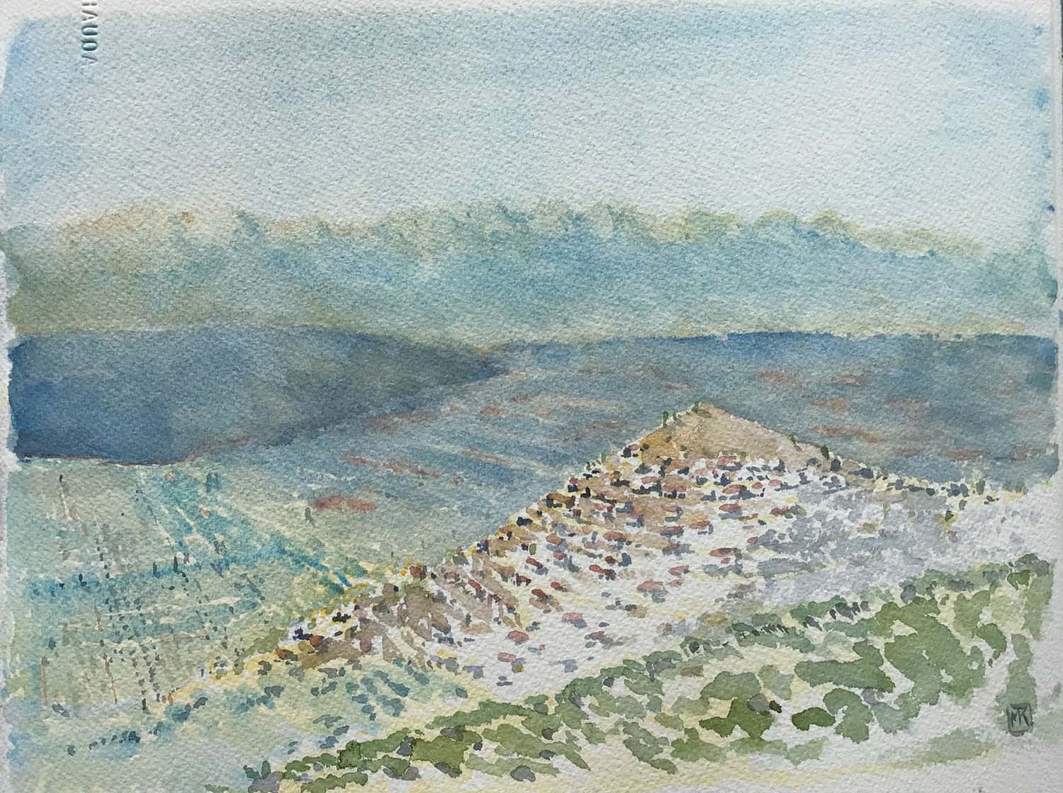
Yeraki (or Geraki) is a town on the Laconian Plain about 40 km from Sparta. I liked the way its red-roofed houses sat on terraces that encircled its mound-like site set above the vast, blue-misted plain. The rich soil on the plain is a beautiful sienna-red; the distant mountains golden where the sun hits facets above the haze. There is a significant ancient/medieval castle site nearby, but its entrance was chained up. [The Indian red patches were added on to an initial very light ultramarine wash, which was then supplemented with more ultramarine, more water-mist, and some sponging to get the softness of the distant plain. The near plain, on the left, is stroked over with cerulean blue to indicate the olive groves. The town itself is painted on much drier paper, parts of which have no underpainting at all] |
The trip ended in Heidelberg, Germany